Special Topic
Walled cities, orthogonal grids, the ward system, and the central axis — how 3,000 years of Chinese emperors ordered space to embody power. From the first rammed-earth capitals of the Shang dynasty to the UNESCO-inscribed Beijing Central Axis of 2024.
Chinese cities were defined by walls before they were defined by streets. The earliest known urban centers — Erlitou (c. 1900-1500 BCE) in the Yellow River valley — already featured rammed-earth palace enclosures. By the Shang dynasty, the Zhengzhou City Wall (c. 1600-1400 BCE) enclosed a city of roughly 25 square kilometers with a perimeter of 7 kilometers, its rammed-earth base up to 20 meters wide and 10 meters tall. The wall was not merely defensive: it marked the boundary between civilized order and the wild, untamed world beyond. The square plan echoed the ancient Chinese conception of a flat, four-cornered earth, making every walled city a miniature cosmos governed by the same rules as the empire itself.
The blueprint for the ideal Chinese capital was fixed in the Rituals of Zhou (Kaogongji, compiled c. 300 BCE): a square city of nine li per side, three gates per wall, nine north-south and nine east-west avenues, with the court facing south and the markets behind it. Tang dynasty Chang'an realized this ideal at colossal scale. At 84 square kilometers, it was the largest city on earth — seven times the size of contemporary Constantinople. Its streets formed a strict grid of 108 walled wards (fang), each with its own gates locked at night under curfew. The central Zhuque Avenue measured 147 meters wide. Commerce was confined to the Eastern and Western Markets — an urban order so rigid that even street vendors were regulated. This ward system would shape Chinese capitals for 700 years.
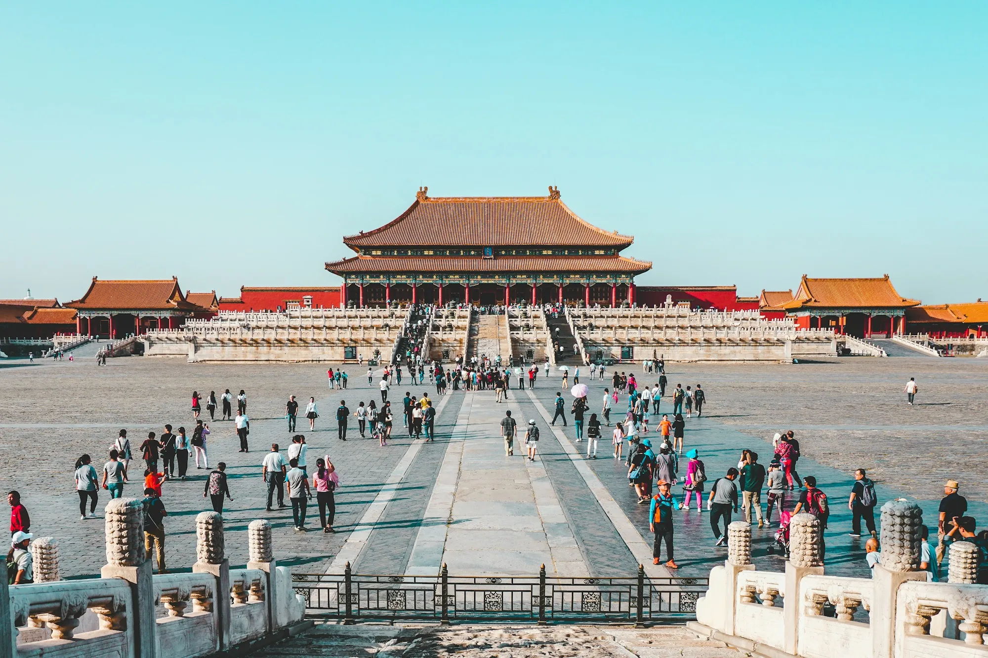
The most enduring idea in Chinese urban planning is the central axis — a single north-south line of supreme significance. The axis reached its apotheosis in Beijing: 7.8 kilometers from Yongding Gate in the south to the Bell and Drum Towers in the north, passing through the Tiananmen Gate, the Forbidden City, and Jingshan Hill. Every major structure on the axis was built to be viewed in symmetrical relation to it; the emperor's throne in the Hall of Supreme Harmony sits precisely on the line, flanked by the ceremonial architecture of the empire's civil and military power. In 2024, UNESCO inscribed the Beijing Central Axis as a World Heritage Site, recognizing it as the most complete expression of a planning tradition stretching back to the Zhou dynasty's 'center as the seat of kingship' (zhongli weizhong).
Before a single wall was raised, a Chinese city's location was chosen by geomancy (fengshui). The ideal site faced south, with mountains protecting the north (the direction of cold winds and, symbolically, of barbarian threat), water flowing before it, and an open plain beyond. Beijing itself sits at the northern edge of the North China Plain, sheltered by the Yan Mountains — a textbook fengshui position chosen by the Ming emperors. The Ming Tombs demonstrate the principle in its purest form: thirteen imperial mausolea arranged in a horseshoe of hills that open to the south, each sited so that the emperor's spirit could look out over his realm. Cities and tombs alike oriented their gates, halls, and streets to harness the auspicious flow of qi — a practice that made Chinese planning at once astronomical, topographical, and religious.
The great Chinese capitals solved problems of supply and drainage on a scale no other pre-modern city approached. Chang'an's water came from a network of canals and reservoirs channeled from the nearby rivers. The Grand Canal — begun under the Sui dynasty in the 7th century and extending 1,776 kilometers from Beijing to Hangzhou — bound the capitals to the rice-producing south and remains the longest artificial waterway in the world. Yuan dynasty Dadu (modern Beijing) owes its lakes to the engineer Guo Shoujing, whose Tonghui Canal (1293) connected the city to the canal system; his waterworks still shape the Beijing landscape. Drainage was equally sophisticated: the Song dynasty 'Fushou Drainage' system of Ganzhou (built 1068-1077) still protects the city from flooding today — more than 950 years of continuous service.
From the Han capital Chang'an through Luoyang, Kaifeng, Nanjing, and Beijing, Chinese planners rebuilt the same ideal city again and again — a tradition unique in world history. Each new dynasty founded a capital that acknowledged its predecessor's plan while perfecting it. Yuan dynasty Dadu, planned by Liu Bingzhong in 1267, imposed a near-perfect grid of broad avenues and narrow alleys (hutongs) that survives intact in central Beijing today. When the Ming built Beijing on the same site in 1406-1420, they reoriented the whole city to the axis of the Forbidden City. The result is a palimpsest: a city whose streets, gates, and sacred buildings still encode 3,000 years of Chinese ideas about order, power, and the cosmos — and one that any visitor can read with the right keys.
The same ideal city, rebuilt for two thousand years. Each dynasty perfected its predecessor's plan — and every capital below still shapes the city that stands on its site today.
| Capital | Period | Planning Legacy |
|---|---|---|
| Chang'an (Han) | 202 BCE-25 CE | First monumental imperial grid, 12 gates, ritual axis |
| Luoyang (Northern Wei) | 493-534 CE | Perfect 9×9 grid; 220 wards; model for Tang Chang'an |
| Chang'an (Tang) | 618-904 CE | 108 wards, 147m central avenue, world's largest city |
| Kaifeng (Song) | 960-1127 CE | First capital to break the ward curfew; night markets |
| Dadu (Yuan) | 1267-1368 CE | Liu Bingzhong's grid; hutongs still trace its alleys |
| Beijing (Ming-Qing) | 1406-1911 CE | 7.8km axis, Forbidden City at center, UNESCO 2024 |